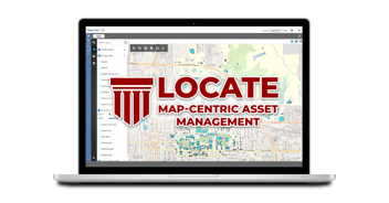
In the world of Facility Management, the pressure to maintain efficiency, ensure safety, and optimize resources is relentless. Enter Geographic Information Systems (GIS) – a technological marvel that is transforming how facilities and assets are managed.
Imagine having a dynamic, interactive map that not only shows the layout of your entire real estate portfolio but also provides real-time data on every asset, maintenance schedule, and spatial usage pattern. This isn't science fiction; it's the reality of integrating GIS into your facility management software.
In this blog we'll uncover why GIS is becoming an indispensable tool for Facility Managers striving to stay ahead in an increasingly complex and demanding environment.
Table of Contents
What is GIS?
Background of GIS
Geographic Information Systems (GIS) is a powerful technology that allows users to capture, store, manipulate, analyze, manage, and present spatial or geographic data. Essentially, GIS enables the visualization of data in a spatial context, which can reveal patterns, relationships, and trends that are not readily apparent through traditional data analysis.
How Does GIS Work
GIS works by linking spatial data (where things are) with attribute data (what things are). This allows users to create interactive queries (user-created searches), analyze spatial information, edit data in maps, and present the results of these operations. For example, GIS can be used to map the locations of infrastructure, analyze the spatial relationships between different geographic features, and model scenarios to predict future outcomes.

Read More: FacilityForce to Unveil Map-Centric Asset Management Solution
Why your FM System Should Leverage your GIS Data
A Facilities Management (FM) system leveraging a Geographic Information System (GIS) database can bring substantial advantages that significantly enhance operational capabilities and overall management effectiveness. Here’s why integrating a GIS database into an FM system is crucial:
Enhanced Spatial Visualization and Understanding
GIS offers interactive maps and spatial data visualization tools that provide a clear, intuitive view of facility layouts, asset locations, and spatial relationships. These tools enable facility managers to swiftly grasp the spatial context of assets, infrastructure, and spaces, thereby enhancing planning and decision-making processes.
Comprehensive Asset Management
GIS facilitates accurate mapping and tracking of all assets within a facility, encompassing their locations, conditions, and maintenance histories. Integrating GIS enables spatially-based scheduling and prioritization of maintenance tasks, leading to optimized resource allocation and minimized downtime.
Optimal Space Utilization
GIS analyzes space usage patterns and occupancy data, identifying opportunities to enhance space utilization and operational efficiency. This enables facility managers to make more effective space planning and allocation decisions using real-time spatial insights provided by GIS.
Data-Driven Decision-Making
GIS seamlessly integrates spatial data with other FM system data, empowering comprehensive analysis and informed decision-making. Facility managers leverage GIS for predictive modeling and scenario planning, evaluating the potential impacts of changes and optimizing operational strategies accordingly.
Improved Collaboration and Communication
GIS serves as a centralized platform for sharing spatial data across departments and with external stakeholders. The interactive maps and visualizations generated by GIS improve communication and collaboration, ensuring stakeholders maintain a cohesive and informed view of facility operations and strategies.
Conclusion
Finding a Facilities Management (FM) system that seamlessly integrates with your Geographic Information System (GIS) is crucial for maximizing operational efficiency and strategic decision-making in facility management. An integrated FM and GIS system enables facility managers to harness the power of spatial data, providing a comprehensive view of asset locations, space utilization, and infrastructure management. This integration enhances the accuracy and accessibility of critical information, such as asset conditions, and maintenance schedules, ,all within a spatial context.
By leveraging GIS capabilities within their FM system, organizations can optimize resource allocation, streamline maintenance workflows, improve space planning, and enhance communication across teams and stakeholders. Ultimately, choosing an FM system that integrates with GIS empowers facilities to achieve greater efficiency, responsiveness, and sustainability in managing their physical assets and spaces.
"The synergy between FM and GIS isn't just about maps; it's about harnessing spatial data to drive smarter decisions and superior facility management"
Would you like to learn more?
Related Resources:
- Facilities Management Overview
- What is the Best IWMS Software for Government?
- The State of Alaska Tackles Statewide Deferred Maintenance
- Why Capital Budgeting Software is Critical in Government Facilities
- Three Keys to Effective Space Management
- Facilities System Integration
- FacilityForce's IWMS Solution


